
Smarter Sites,
Sharper Allocation
Your Operational Command Center
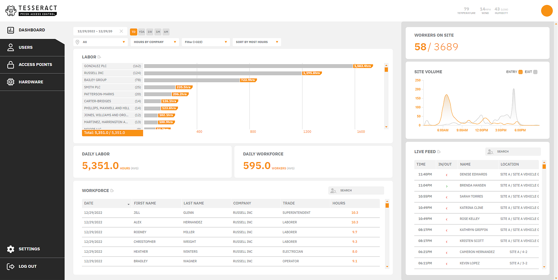
We can deliver a centralized, customizable visual dashboard that enables leadership to monitor multi-site operations, manage supplies, and optimize workforce allocation in real time.

Echo
Digital Twin Platform
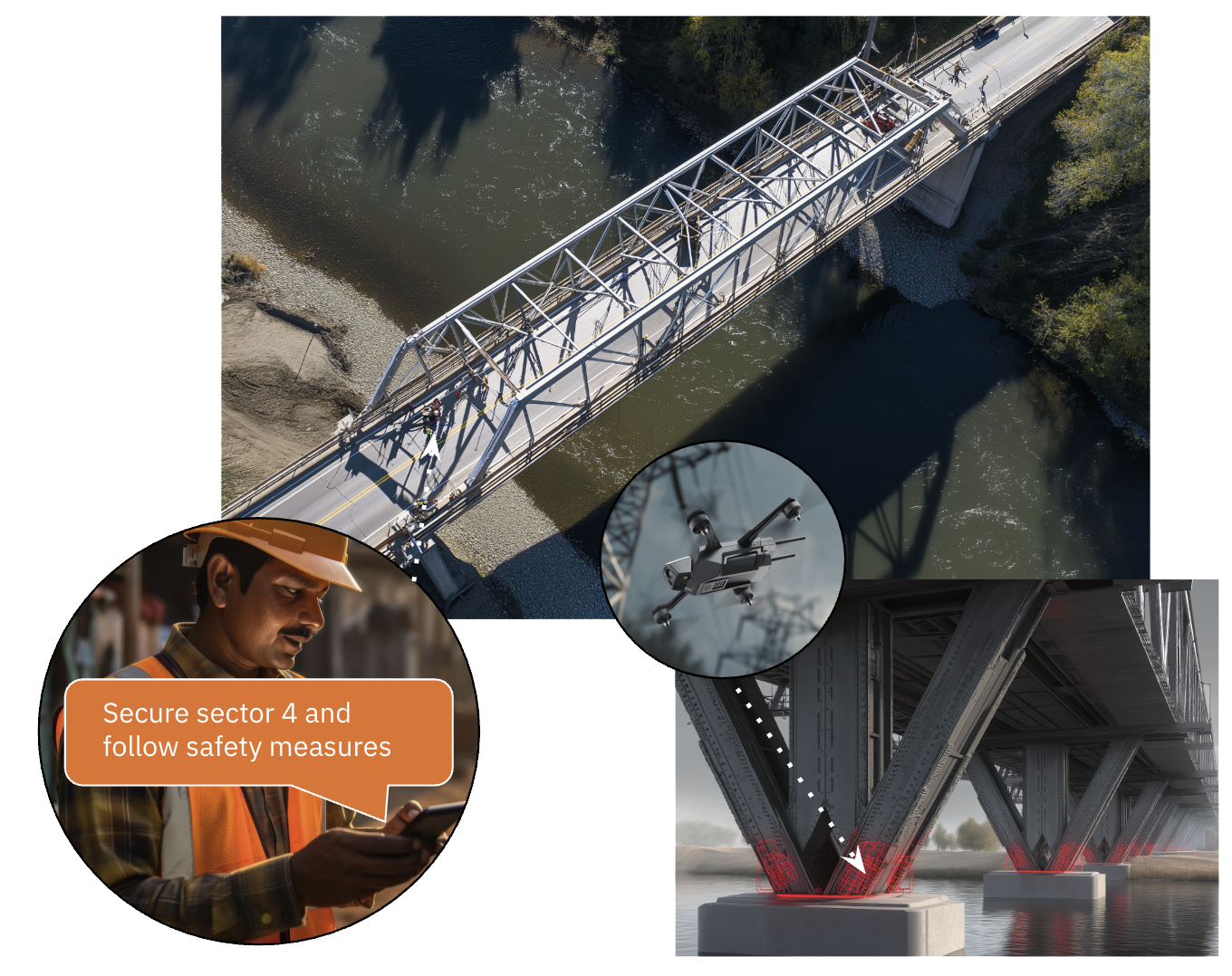
Tesseract’s ECHO is a versatile visualization tool that transforms complex datasets into clear, actionable interfaces for rapid decision-making. Receiving secured data from MOSAIC, ECHO tailors information presentation to specific use cases.
Live Dashboards: Integrates all the data sources into a single operational picture (inspections, work and military sites, weather, incidents).
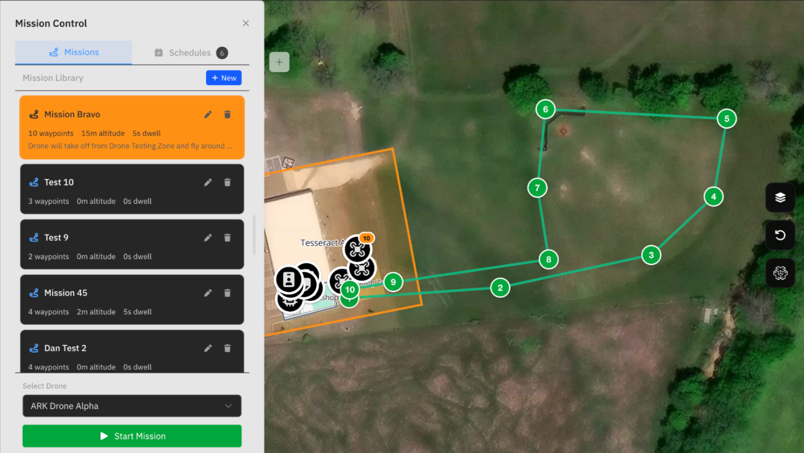
Remote Control: Manages all ecosystem assets (drones, signs, sensors) from one interface.
Digital Twin Integration: A dynamic, data-rich virtual model of any infrastructure that displays and records remote locations, drone imagery, people, and historical event replays for predictive modeling.
Tesseract Synthesis
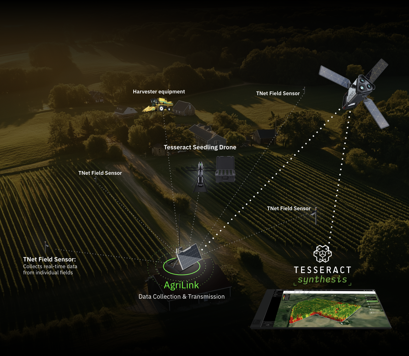
Tesseract AgriLink connects and networks Ag Sensors and Edge Robots to visualize and react to real-time conditions. The suite of sensors includes soil moisture and temperature, leaf wetness, air temperature and humidity, nutrient and light intensity sensors, pest and even disease-detection cameras, and data from drones.
Our comprehensive Tesseract Synthesis aggregates and processes large volumes of real-time machine, soil sensor, and daily satellite imagery to deliver actionable agricultural insights. It works across online and offline environments and lets you customize data sources to fit your unique operational needs. From financial management—including ROI calculations and claims processing—to streamlined sustainability tracking for compliance, the platform provides everything required to optimize farm performance. Looking ahead, advanced AI forecasting and smart recommendations will further empower data-driven decisions.
Site Manager
Site Manager is a real-time operational intelligence platform that acts as a live digital twin for physical locations and field operations. Powered by the MOSAIC microservices backend, it unifies IoT sensors, drones, surveillance, personnel, and equipment into a single command center for complete remote visibility.
Equipment Management: Tracks full lifecycle inventory, maintenance, and inspection data, optimized for predictive analytics.
Field Observations: Captures map-indexed photos, videos, and auditable notes attached to specific sites or structures.
Intelligent Alerting: Sends instant notifications triggered by sensor data, drone telemetry, or operational thresholds.
AI-Ready Analytics: Combines an integrated data warehouse with natural-language querying for instant insights.
TAK/CoT Support: Integrates natively with TAK Servers via Cursor-on-Target for defense-grade interoperability.
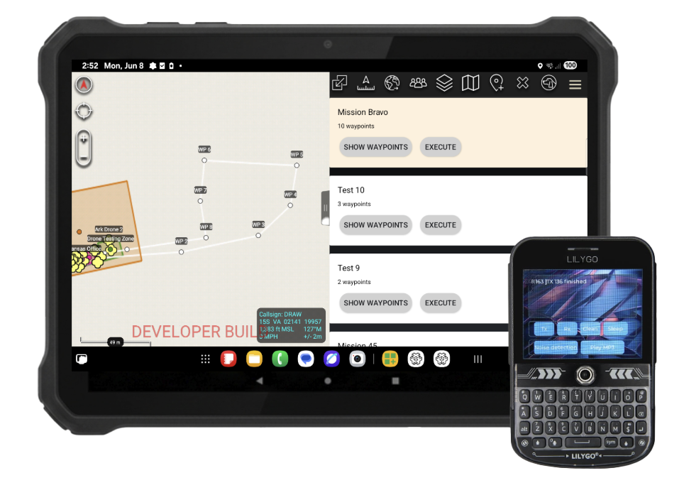
Drop waypoints in ATAK to map automated drone routes, while live sensor overlays track assets in real time—streamlining mission planning and maximizing situational awareness.
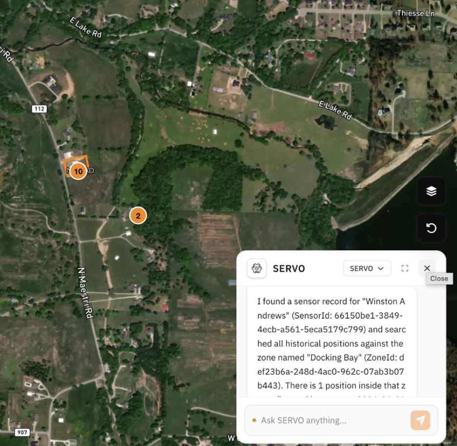
Servo is a component of Site Manager that consolidates fragmented hardware into a single interface to provide real-time control, predictive maintenance, and maximum mission readiness for automated defense assets—all driven by large language model queries run through an integrated ChatGPT window.